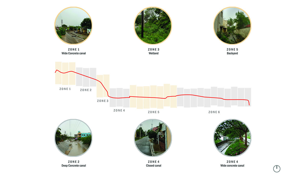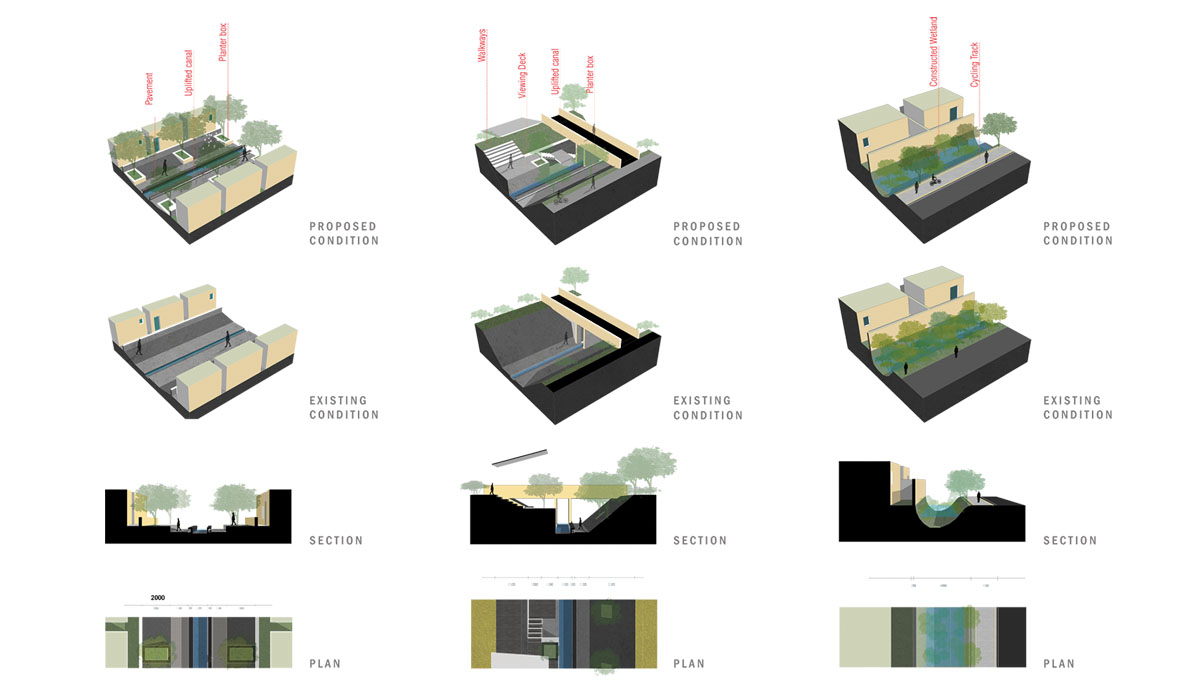
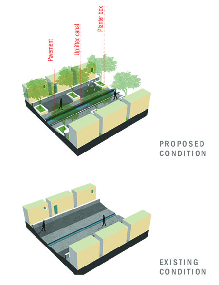
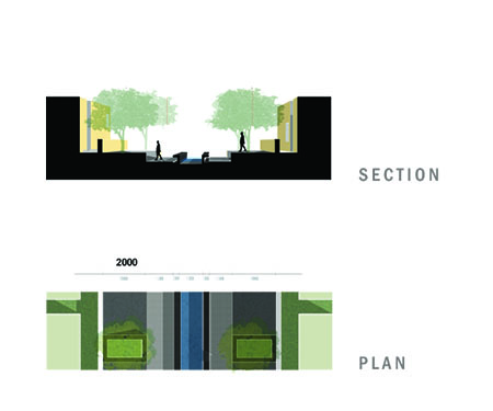
Zone 1
Concrete -Wide
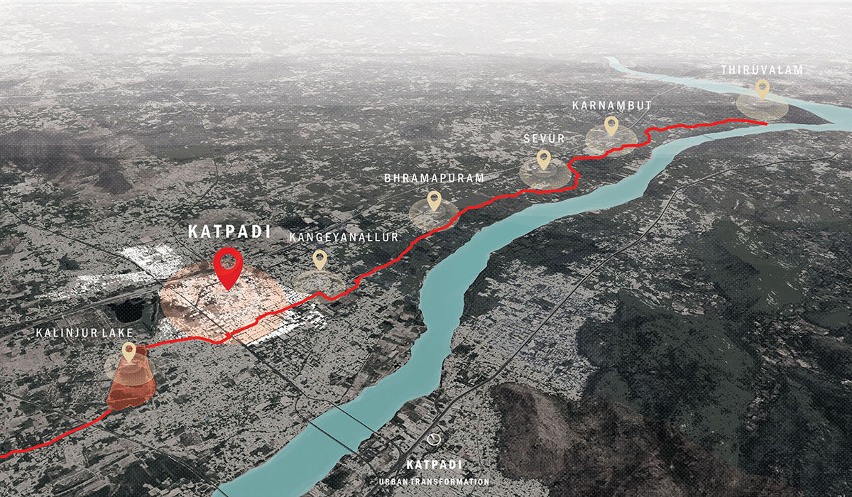
The Irrigation canal starts from Kalinjur lake, the initial low lying areas of the canal have slums on both sides. The existing canal is used as a dump yard. The design proposal is to reduce the water channel and have planter boxes and seaters in the remaining area to invite people to use the canal as a backyard.

Zone 2
Concrete -Deep
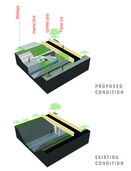
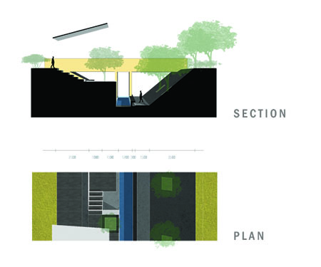
The Irrigation canal runs through a deep concrete canal past the slum. The canal is empty and unused for almost 8 months, instead can be used for recreational activities. The Design proposal is to have multilevel recreational spaces that can be used in almost every season with altering water level.

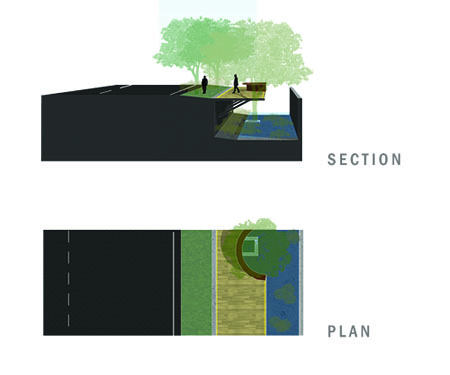
Zone 3
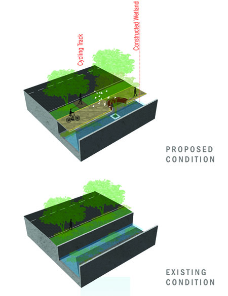
Wetland
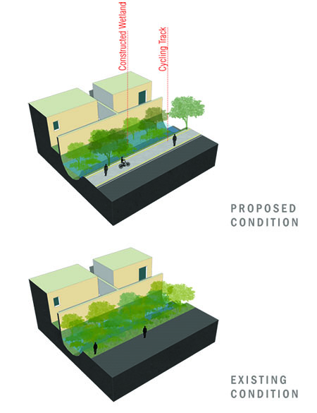
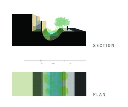
The Irrigation canal channels down to a narrow wetland as it enters the household neighbourhood. In the existing state, wetlands are grown wild and hard to maintain. The design proposal is to transform the zone into constructed wetland and introduce cycle lane along the constructed wetland.

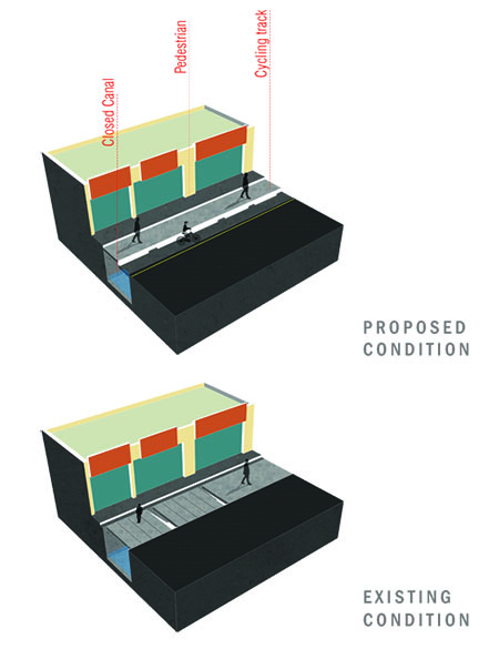
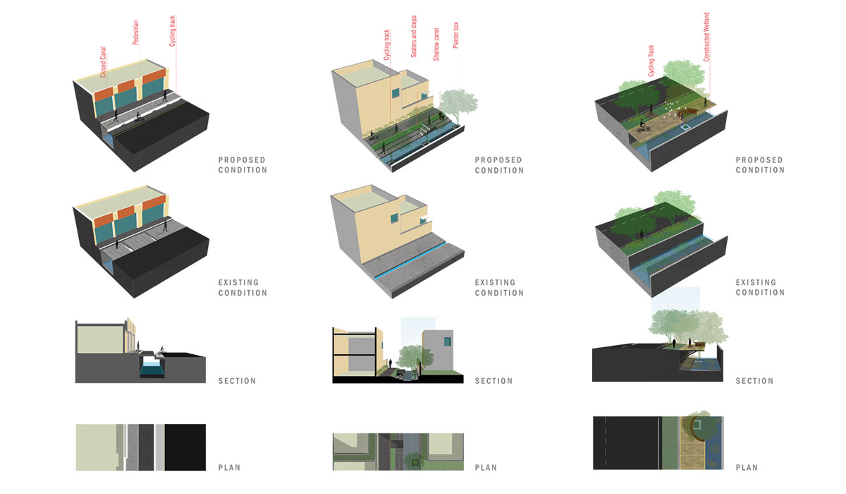
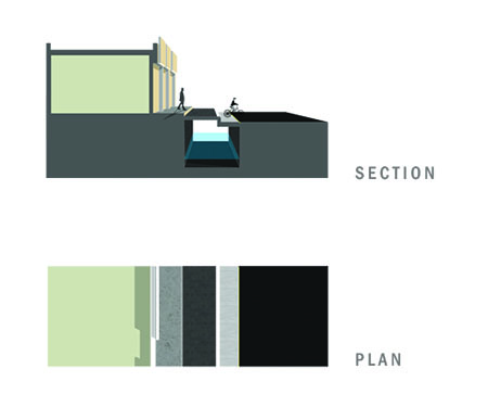
Zone 4
Closed Canal
The Irrigation canal channels reaching the commercial spine gets closed with concrete planks as the streets are lined with commercial shops. The design proposal is to construct an underground trench below and use the slab of the trench as pathways and cycling track. The canal crosses the Chitoor - Bagayam road past this zone.

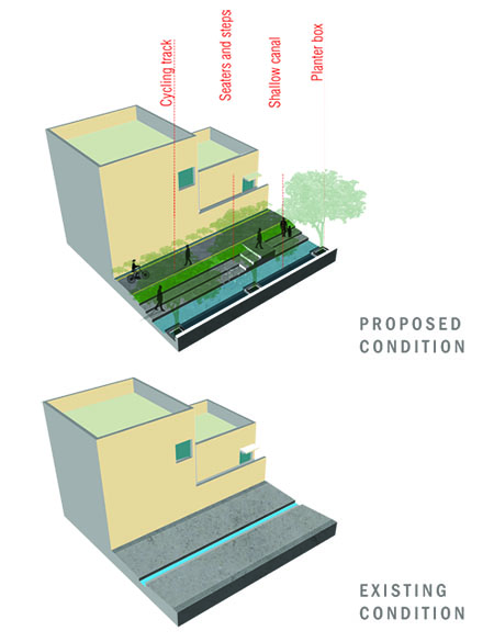
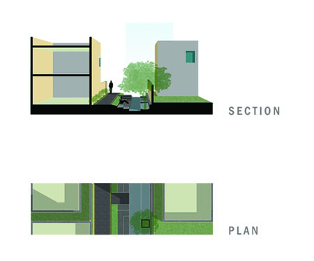
Zone 5
Backyard
The Irrigation canal passing the NH enters the residential neighbourhood's backyard. No houses have opened pathways on the canal side, it's just plain walls. The design proposal is to shift the water channel to one side and introduce pathway on the other. This could attract student a ttention as it's on the way to nearby schools.

Zone 6
Wetland
The Irrigation canal gets passed the Katpadi region through deep-wide wetland passage along the road to Auxillium college. The existing condition is unusable and prone to accidents but has a good number of rain trees. The design proposal is to have a cantilevered deck housing seaters thus hiding half the canal.
Gallery