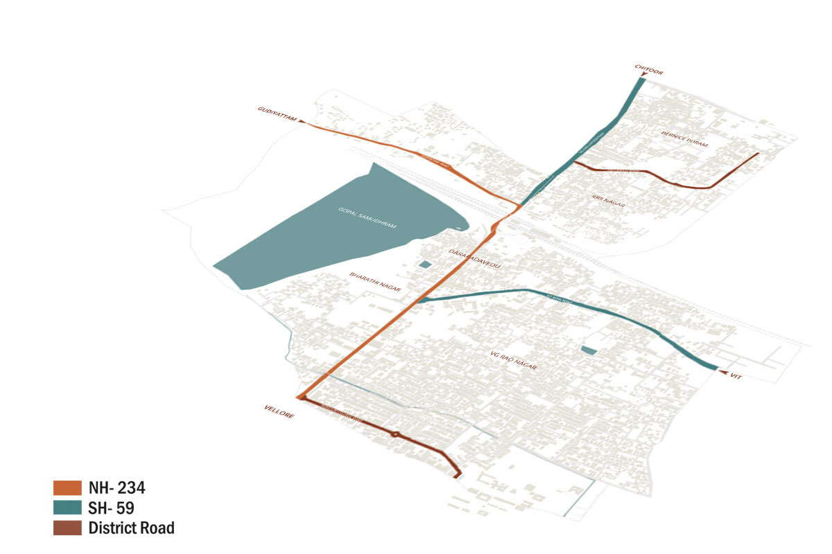
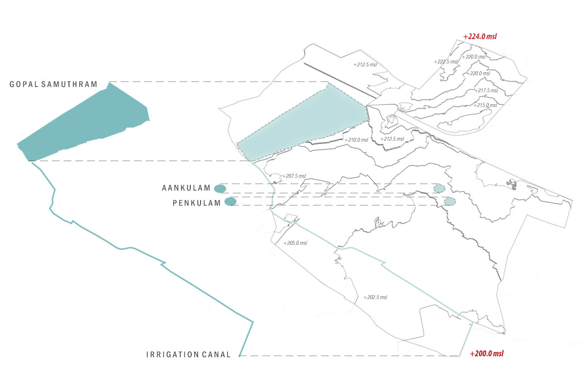
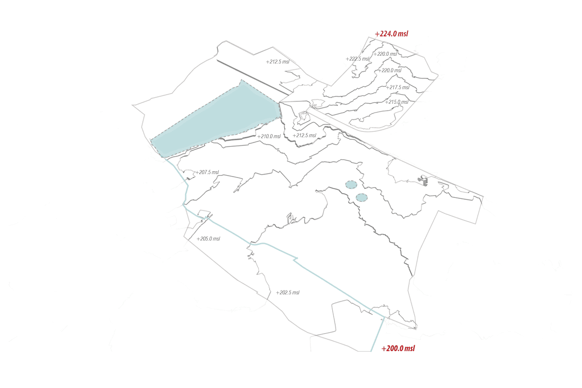
Katpadi

Urban Redevelopment project | Katpadi

Malavika Madhuraj | Siddarth K | Saba Sulthana Shaji | Aarthi Rajaram | Sandra Susan Shibu | Sathish V | Amurdha Sudharsen | Yashitha | Saajidh Ahamed | Aswinth Balaji SR

1852

Katpadi was an agricultural based village. Vellore - Chittoor land route cuts right through Katpadi, acting as the major catalyst. British Raj established the rail route and Katpadi station right at the junction.

1960

By the year 1960, Katpadi as a settlement grew denser around the Junction. The Vellore - Chittoor route with the Railway junction attracted more trade and commerce. Religious settlements grew with religious institutions at their core.

1990

Commercial and Industrial growth served as a precursor to planned residential exapansion. Various Educational establishment started becoming the Catalyst. The development started growing along the primary road

2000

Institutional and educational buildings in and around Katpadi became famous. Vellore - Chittoor route became a crucial highway to bear the crowd inflow. Unplanned residential growth increased on the eastern side of the primary route.

2010

The nearby amenities like CMC and VIT started pulling people from across India. Multiple educational institutions started growing around Katpadi because of the potential. Plot value started becoming costlier as the need increased.

2019

The Institutions started gaining international recognition, bringing more inflow of people. The Vellore-Chittoor Highway started pulling more commercial establishments around.The settlement has grown around the major road networks and towards various institutions.

Contour

Lowest site level - +200.0 msl | Highest site level - +224.0 msl

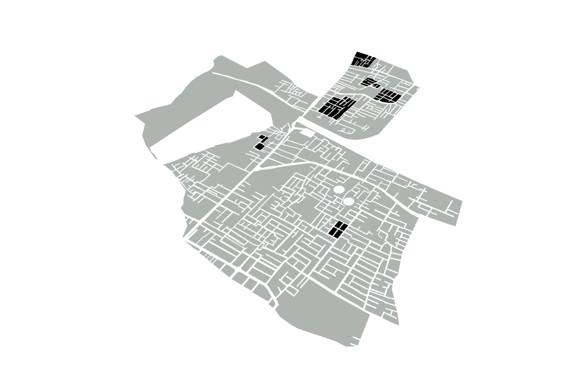
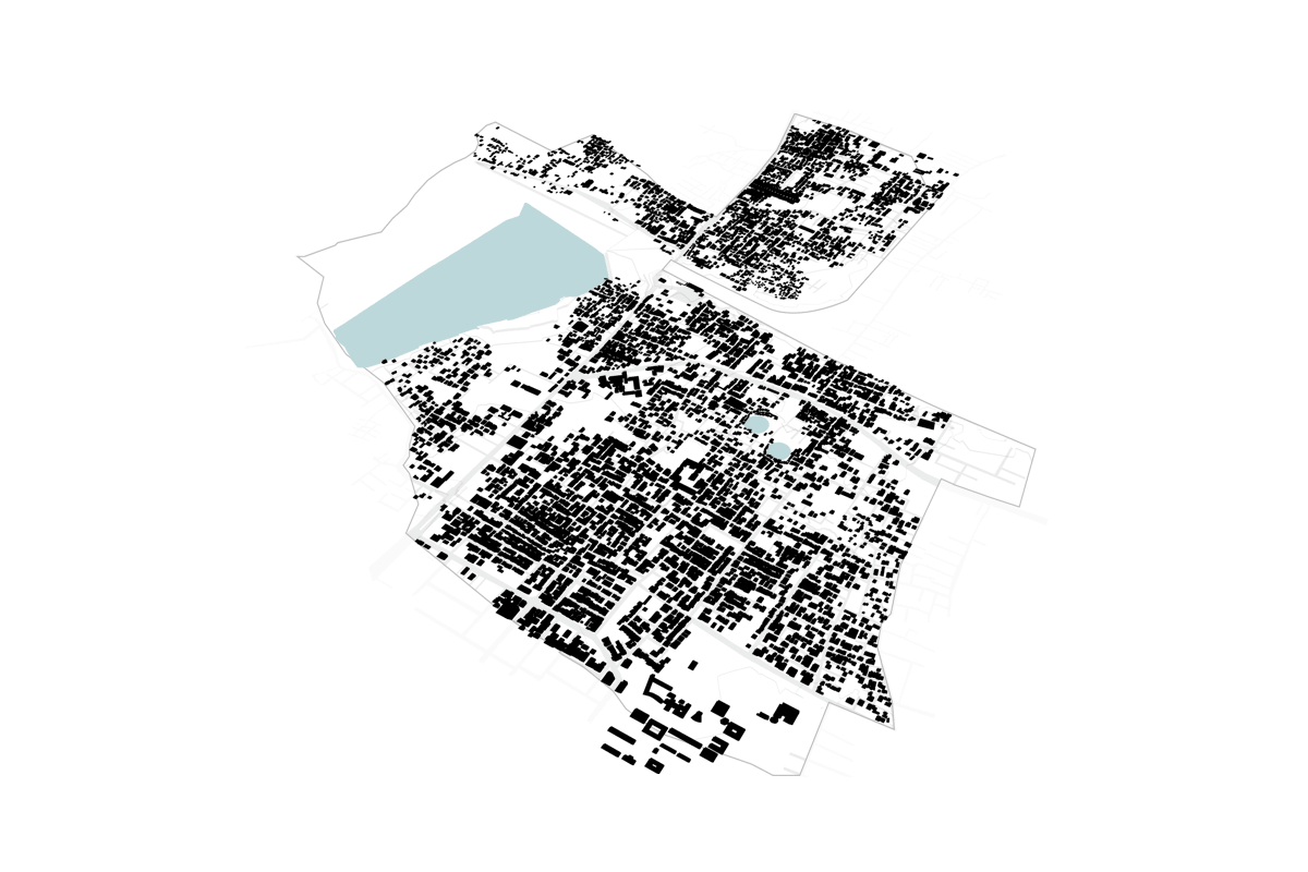
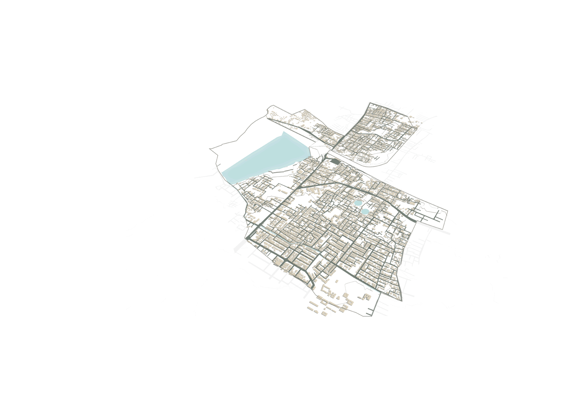
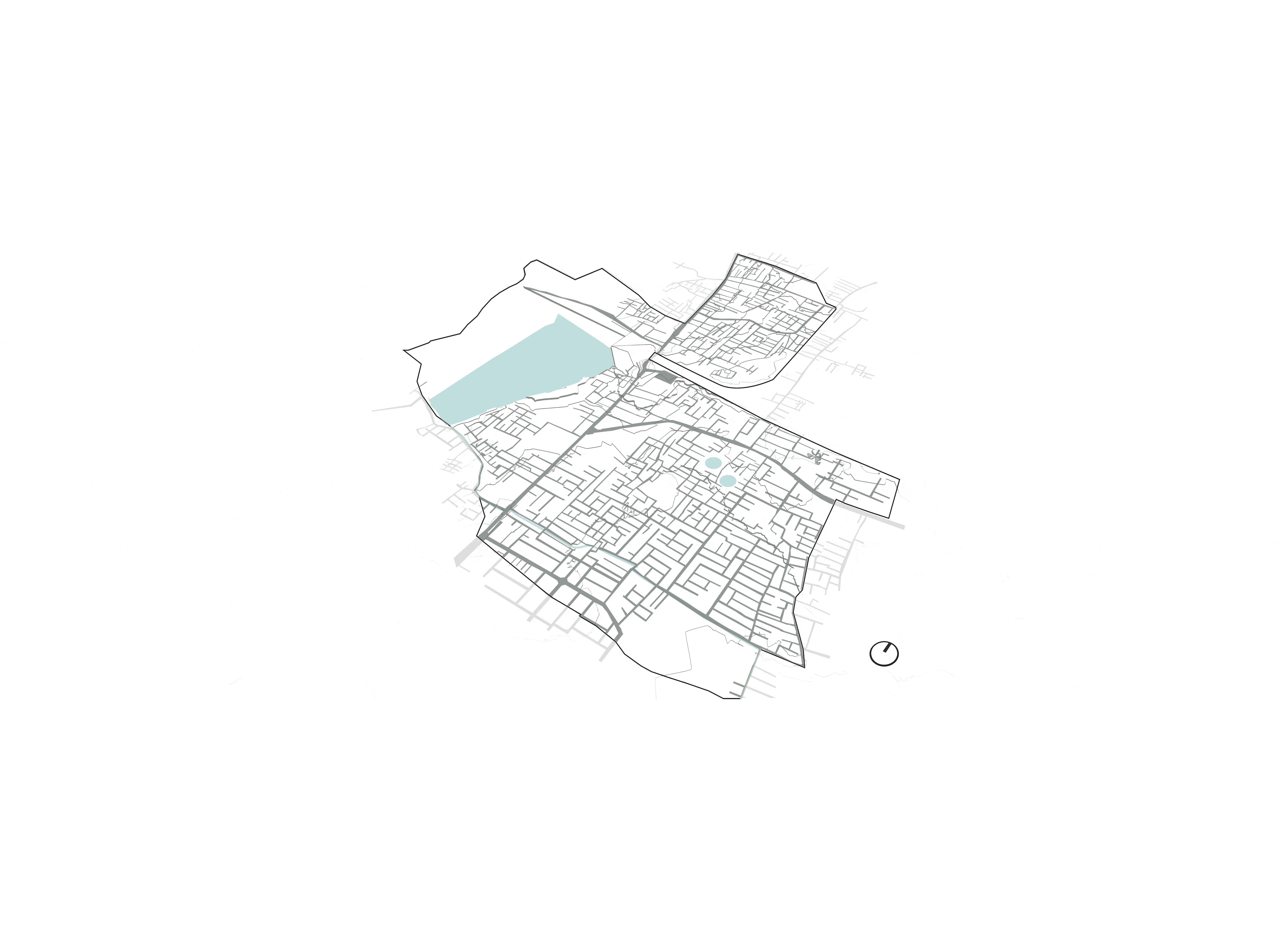
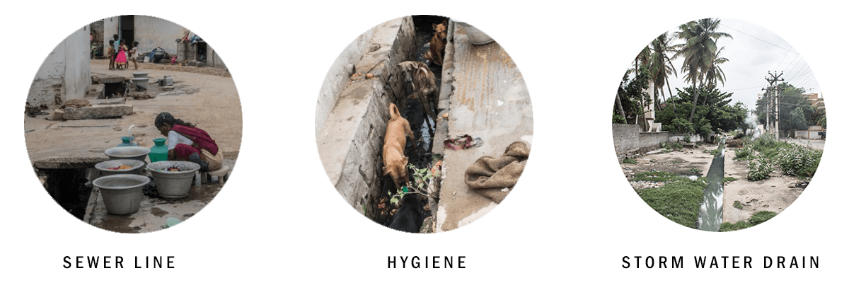
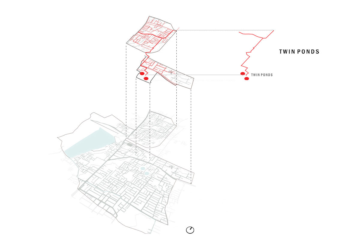
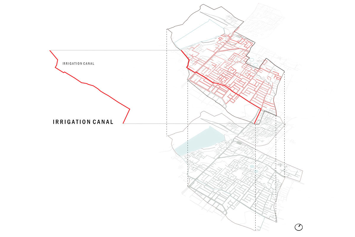
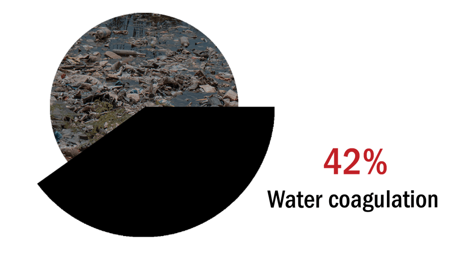
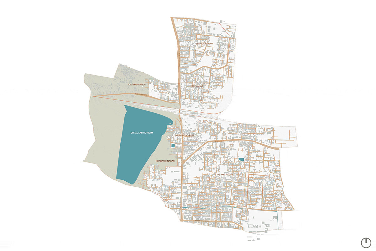
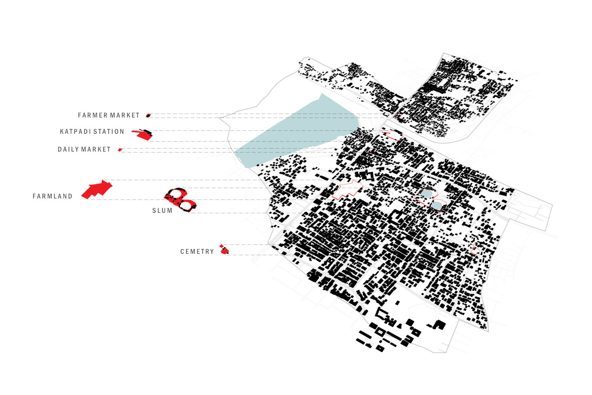
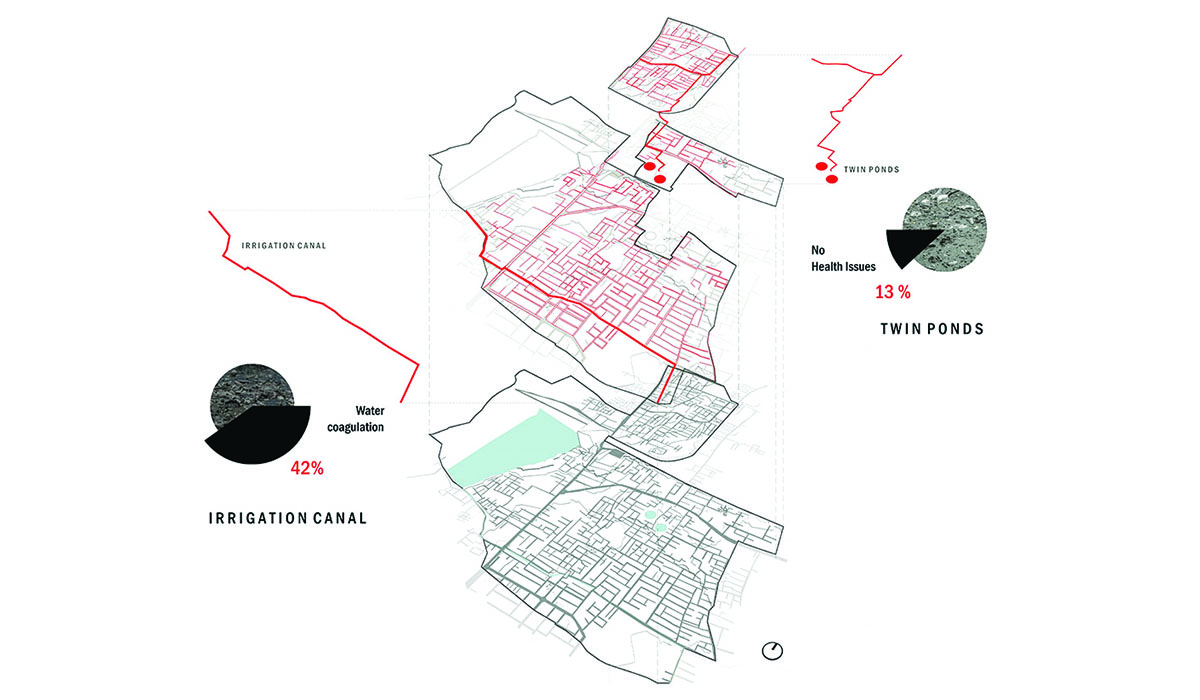
The site contour slopes down towards the Palar river with the highest and lowest level being +224.0 msl and +200.0 msl respectively. Gopal samuthram the natural water catchment lake collects runoff water from the northwestern part of the site. The twin ponds in the site are natural rainwater catchment ponds for Old Katpadi but now are polluted by sullage and sewage lines that open into these ponds. Runoff rainwater of lower parts of the site is connected and carried out of the site through the irrigation canal carrying surplus water from the Kalinjur lake.

Urban fabric

Katpadi has a fine grain urban fabric with small pockets weaved with roads and junctions. But with recent rapid development, the fabric which has to seamlessly evolve over time is failing in most places like VG Rao nagar. Introduction of new blocks are transforming fabrics into fragmented parallels and cul-de-sac which has its own advantages and disadvantages like privacy and less connectivity respectively. This has stopped areas like VG Rao nagar to develop from residential to mixed-use retail to dense urban zones. Now the zone has its own problems like amenities and public transportation access in close proximities.

Figure Ground

Built space - 35 % Unbuilt space - 65 %

Unbuilt spaces mostly fall in the building setbacks and Gopal samuthram lake. As the open space is greater than the built mass and buildings being disconnected from each other thus open voids are lacking spatial definition and ownership. Often these open spaces end up as dump yards, drainage outlet and surface parking.

Road Netwrok

Public to private transport mode share ratio - 38:62 | Pedestrain Mode Share - 30%

15% of the roads are Kutcha road, while 85 percent remains Pucca comprising of Cemenet and Asphalt roads. Mud roads are majorly found in newly developing residential sites. All the primary and seconadary roads are Asphalt made. Cement roads in V.G Rao nagar are proposed to be changed into cement roads in the near future.

Public Transport

City bus supply index - 16

Katpadi being an fine course urban fabric there isn’t larger roads that provides last mile connectivity from centres through public transportation. Henceforth private transportation like auto rickshaw and owned vehicles are modes of transportation that are used frequently. Vellore has a ratio of 2381 autos per 1 lakh people which is larger than mumbai. CMC being a major catalyst for floating population in vellore, Katpadi Junction is the major way of access to vellore from different cities. Bus routes from katpadi to CMC Bagayam serves as a major intra city route. But connectivity to residential zones is a drawback that stops people from using it frequently.

Land Use

89% - Residential | 5% - Commercial

Amenities and Proximity

Most of the amenities like retail, commercial and public buildings are on the commercial spine ie. the Vellore - Chitoor road. Religious structures are spread all around the site. Small temples with single shrine are found in junctions of streets, these small temple pavillions are major gathering area for people of streets. Churches are found on ward 3,5 which has christianity domination on ward population and economically weaker section of ward 6 who are mostly converted christians. The whole site has only 2 mosques out of which one is recently redeveloped main mosque where the whole of katpadi gathers for friday prayers.

Drainage System

Open drains and channels are collecting domestic household’s sullage from all wards and diverting them into natural water bodies like low lying pond areas and irrigation canals. The Upper Katpadi diverts its sullage into the twin ponds in Ward-6, whereas lower Katpadi diverts its sullage into the Kalinjur surplus water canal that traces its path to Palar river. All the open channels that collect sullage are powered by gravity. Sluggish movement of sullage due to the accumulation of sludge and solid waste is thrown into the open channel. Water gets accumulated results in breeding of mosquitos, insects, rodents, stray dogs resulting in unsanitary conditions throughout the area. Irrigation canals are polluted making it unfit for future agricultural purpose.

Twin Ponds

The whole of Old Katpadi’s drainage is collected by the main sewer line and being drained into the male pond in Ward 6. In case of rain and the pond reaching max height, the channel to the female pond nearby is cut open. This leaves the site surrounding pond unfit for living with its ground water polluted, soil contaminated henceforth it has become an easy place for very low economic people to settle in as slums. Thus the ponds which were natural rainwater catchments has lost its identity and connection to the city. Drainage lines from ward 3, 5 clogs while trying to cross the railway line and divert into nearby lands and form pools of drainage water inhabiting pigs, rodents, snakes and mosquitos. With almost every street having only open drains collecting sullage there are health issues in every ward with mosquitos and rodents.

Irrigation canal

The present Kalinjur Surplus canal carries the overflown water from Kalinjur lake which has become a rare scenario. In recent times the canal has been pumped with untreated sullage from the households diverting into the Palar river. In ward 6 it also acts as a concrete storm water drain which has been polluted the inhabitants by continous letting out of drainage and dumping of waste. The main sewer line takes a turn along the auxillium college’s perimeter and takes the route through Kangeyanallur, Brahmapuram, Sevur, Karnambut and dumps the waste into Palar river at Thiruvalam.

Urban Redevelopment project | Katpadi

Malavika Madhuraj | Siddarth K | Saba Sulthana Shaji | Aarthi Rajaram | Sandra Susan Shibu | Sathish V | Amurdha Sudharsen | Yashitha | Saajidh Ahamed | Aswinth Balaji SR

Gallery