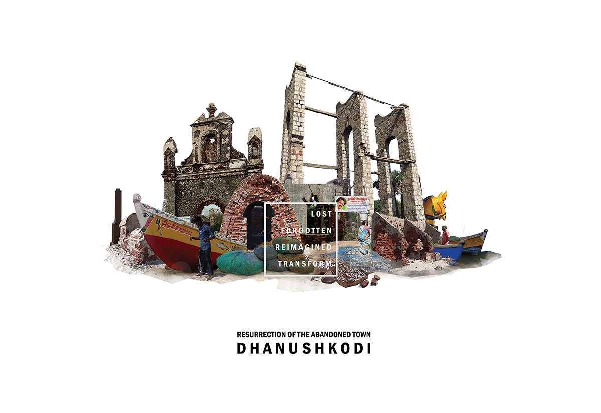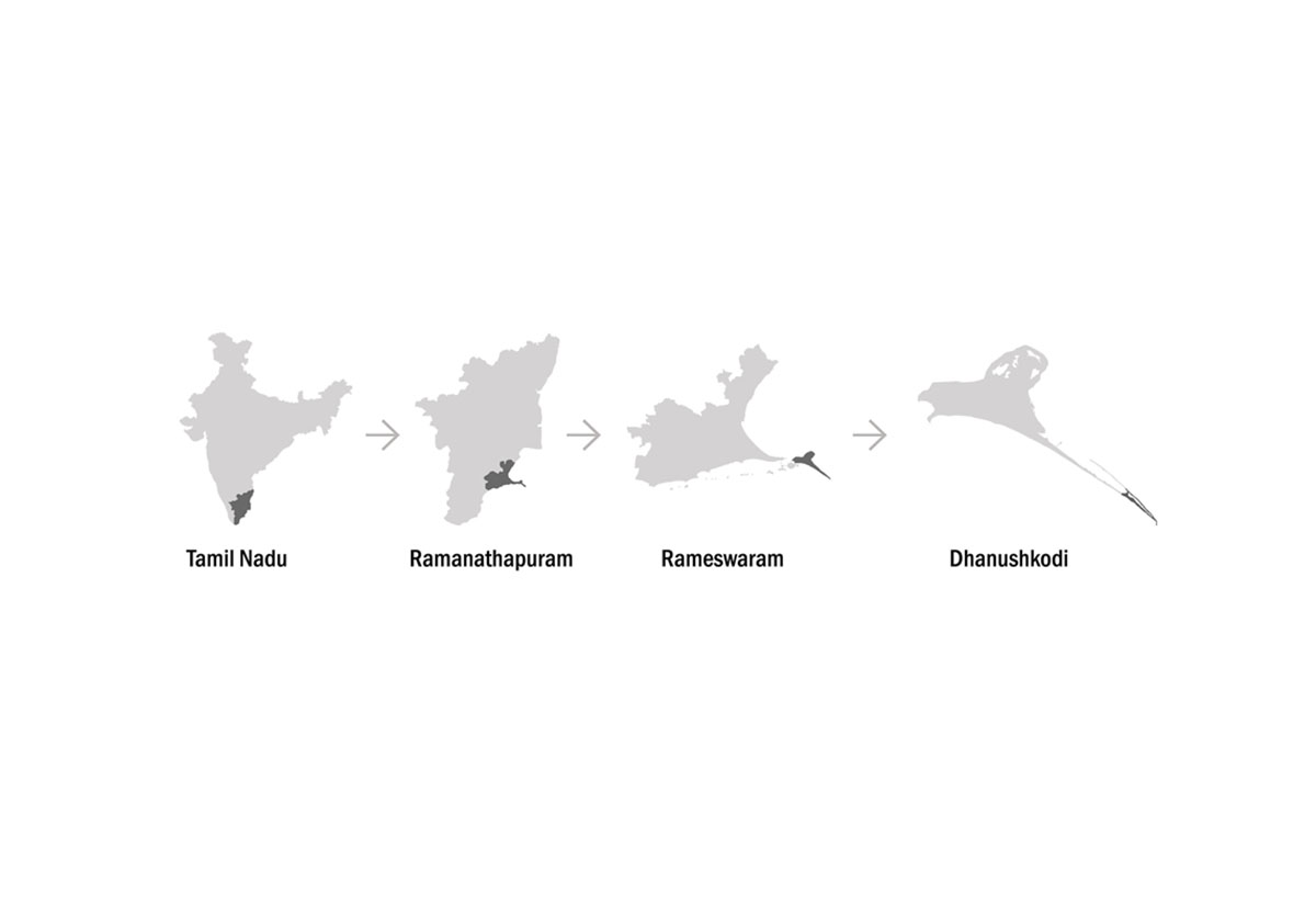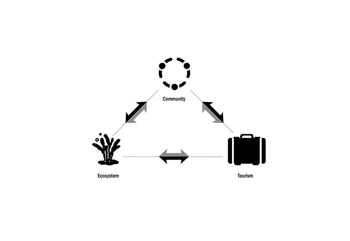

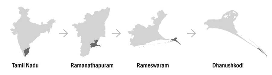
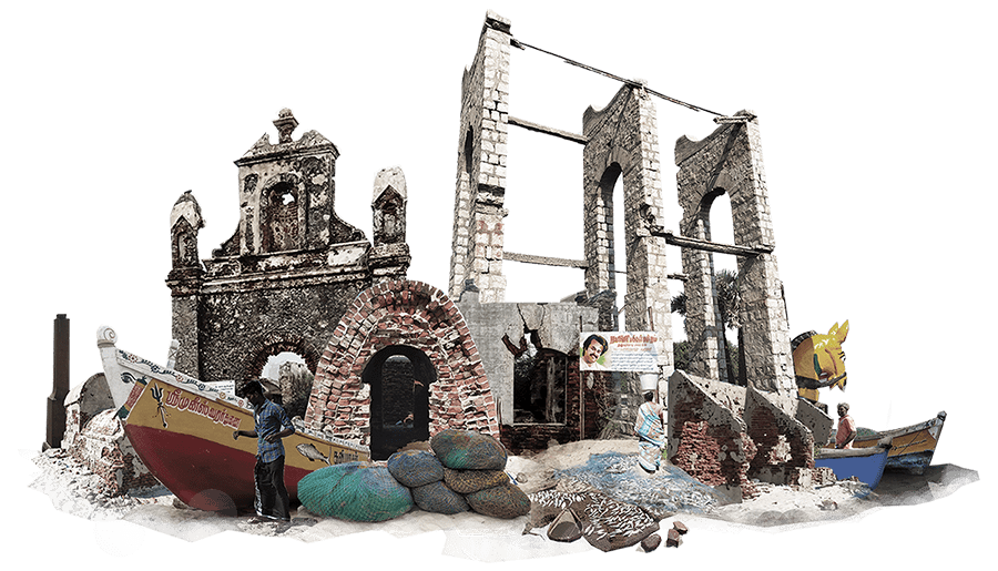
Dhanushkodi is a thin spit land-formation on the south coast of India, where the Bay of Bengal and the Indian Ocean meet. The colonial British established a port town here for ease of trade and movement. In 1964 a cyclone which is considered to be a modern-day super cyclonic storm struck the town at midnight swept away the entire town leaving only the foundations and few walls made of stone. The Government declared the town a ghost town after the effects of the cyclone. The land remained isolated supporting a wide range of natural habitats that include lagoons, dunes, casuarina forests, seagrass beds, coral reefs, and much more. Ensuing the cyclone, access was only through walking or off-road trek limited the number of visitors to the abandoned town. Extension of NH 49 to the tip of the land spit introduced a spike in the tourists landing to catch the sight of the striking seascapes with white sand, blue skies, ruins that stand as a testimony to the forgotten past and to connect with the mythological stories of Ramayana. This sudden boom of tourism has been detrimental in many ways to the local community and its natural ecosystem. This sharp rise cannot be cut back, but it can be processed and managed as controlled tourism.
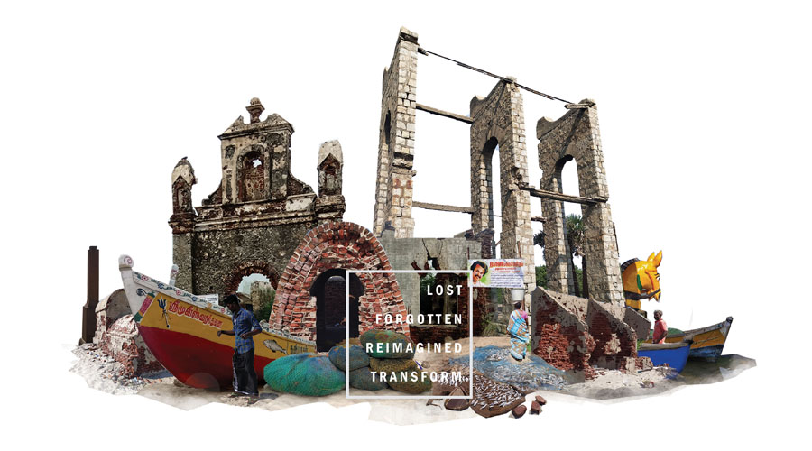
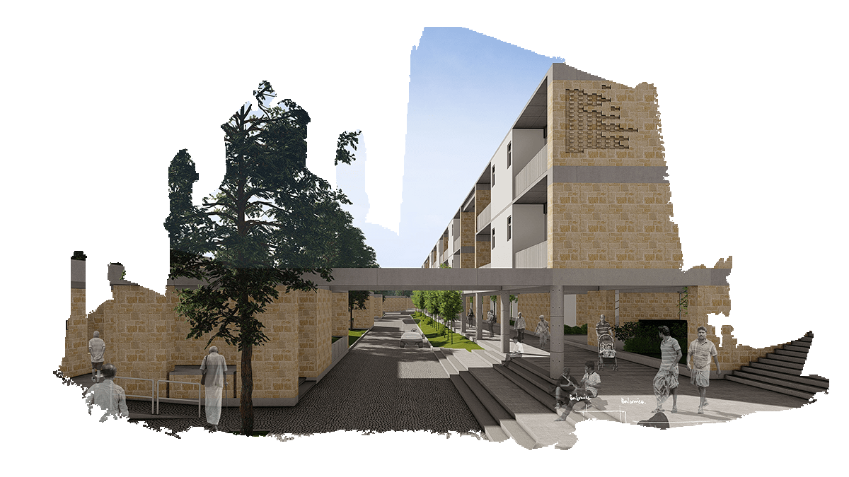
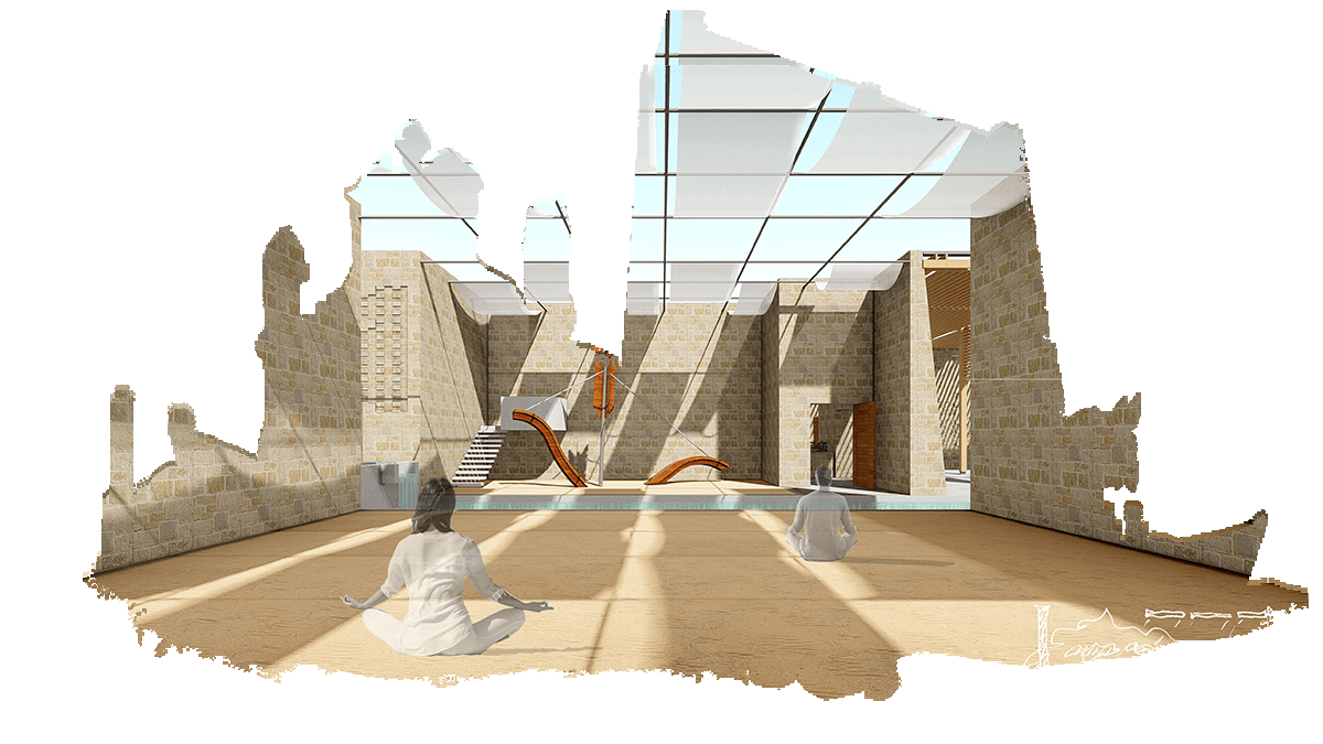
This Architectural thesis focuses on re-imagining the past and transforming the future of the town by celebrating the expression of unity between the distinct natural environment and man-made environment. The abandoned ruins have a compelling beauty, demonstrating a repurposed, rescued architecture to the ruins, and a reimagined architecture adjacent and around it has the beauty and power to change the life of the community and the town.
Thesis Project | Ar.R.M.Valliappan

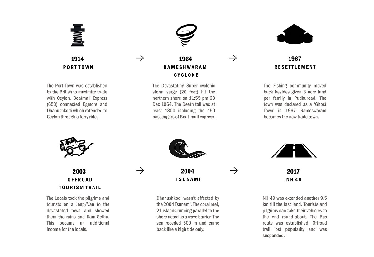
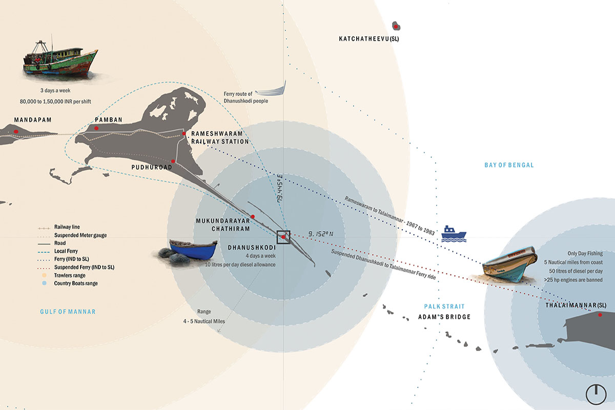
The Port Town was established by the British to maximize trade with Ceylon, Boatmail Express (653) connected Egmore and Dhanushkodi which extended to Ceylon through a ferry ride.

The Devastating Super cyclonic storm surge (20 feet hit the northern shore on 11:55 pm 23 Dec 1964. The Death toll was at least 1800 including, the 150 passengers of Boat mail express.

The Fishing community moved back besides given 3 acre land per tamily in Pudhuroad. The town was declared as a Ghost Town in 1967. Rameswaram becomes the new trade town.

The Locals took the pilgrims and tourists on a Jeep/Van to the devastated town and showed them the ruins and Ram-Sethu. This became an additional income for the locals.

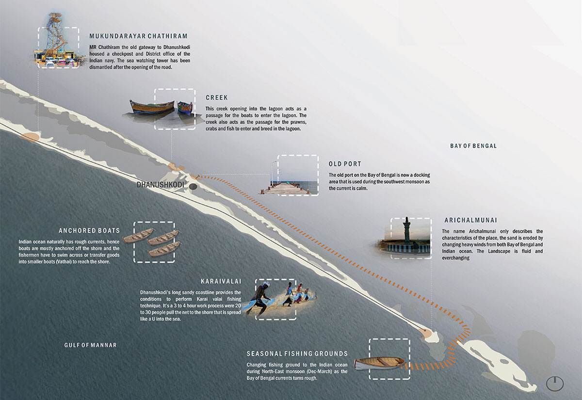
Dhanushkodi wasn't affected by the 2004 Tsunami. The coral reef, 21 islands running parallel to the shore acted as awave barrier. The sea receded 500 m and came back like a high tide only.
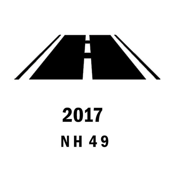
NH 49 was extended 9.5 km till the last land. Tourists can take their vehicles to the end round- about. The Bus route was established later the offroad trail was suspended.
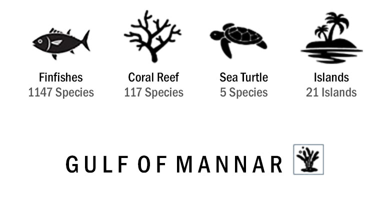
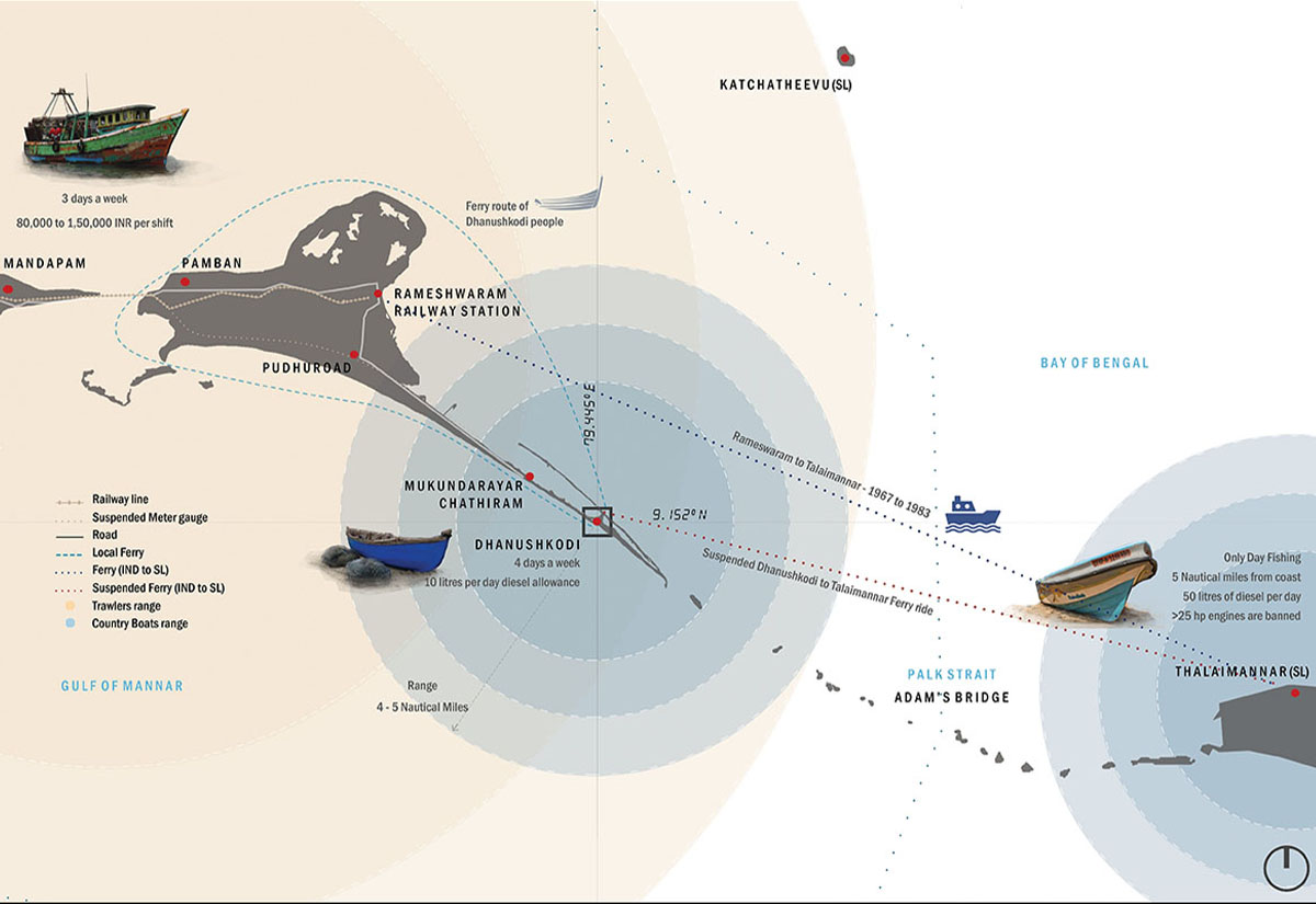
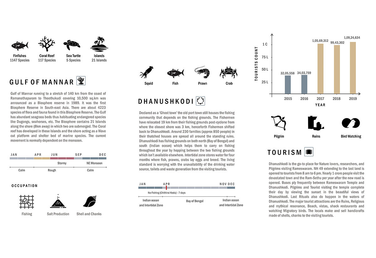
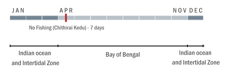
Gulf of Mannar running to a stretch of 140 km from the coast of Ramanathapuram to Thoothukudi covering 10,500 sq.km was announced as a Biosphere reserve in 1989. It was the first Biosphere Reserve in South-east Asia. There are about 4223 species of flora and fauna found in this Biosphere Reserve. The Gulf has abundant seagrass beds thus habituating endangered species like Dugongs, seahorses, etc. The Biosphere contains 21 Islands along the shore (8km away) in which two are submerged. The Coral reef has developed in these Islands and the shore acting as a Wave cut platform and shelter bed of marine species. The current movement is normally dependent on the monsoon.
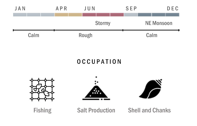
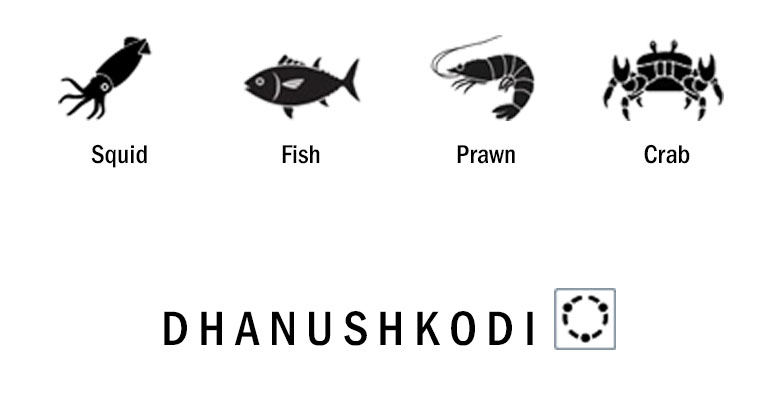
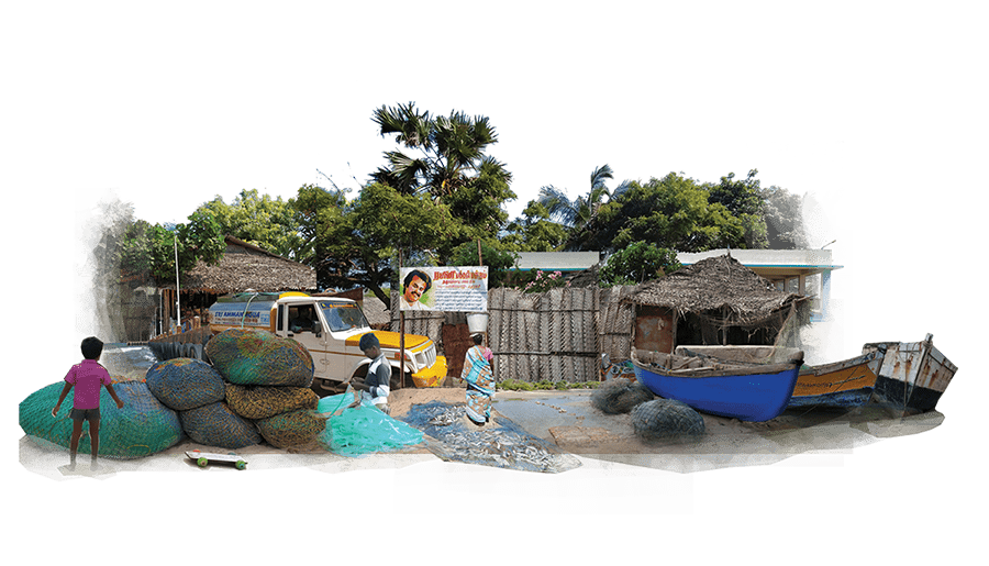
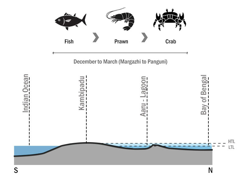
Declared as ‘Ghost town’ the old port town still houses the fishing community that depends on the fishing grounds. The Fishermen have relocated 19 km from their fishing grounds post-cyclone from where the closest shore was 3 km, henceforth Fishermen shifted back to Dhanushkodi. Around 230 families (approx 850 people) in their thatched houses are spread all around the standing ruins. Dhanushkodi has fishing grounds on both north and south (Bay of Bengal & Indian ocean) which helps them to carry on fishing throughout the year by hopping between the two fishing grounds which isn’t available elsewhere. Intertidal zone stores water for four months where fish, prawns, crabs lay eggs and breed. The living standard is worrying with the unavailability of the drinking water source, toilets and waste generation from the visiting tourists.
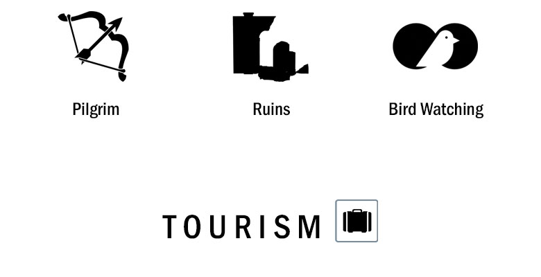
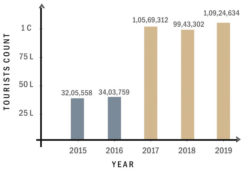
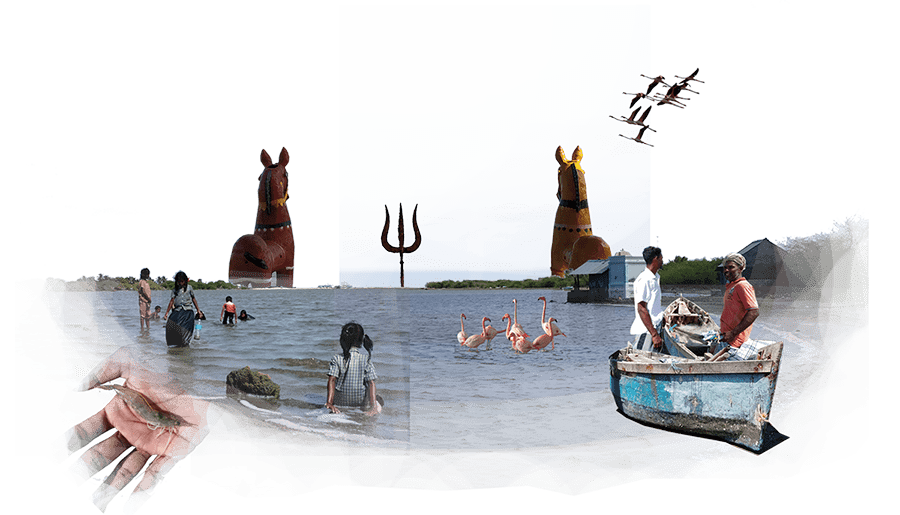
Dhanushkodi is the go-to place for Nature lovers, researchers, and Pilgrims visiting Rameswaram. NH 49 extending to the last land is opened to tourists from 8 am to 6 pm. Nearly 1 crore people visit the devastated town and the Ram-Sethu every year after the new road is opened. Buses ply frequently between Rameswaram Temple and Dhanushkodi. Pilgrims and Tourist visiting the temple complete their day by viewing the sunset in the beautiful landscape of Dhanushkodi. Last Rituals also do happen in the waters of Dhanushkodi. The major tourist attractions are the Ruins, Religious and mythical resonance, Beach, vistas, shack restaurants and Migratory birds. The locals make and sell handicrafts made of shells, chanks to the visiting tourists.
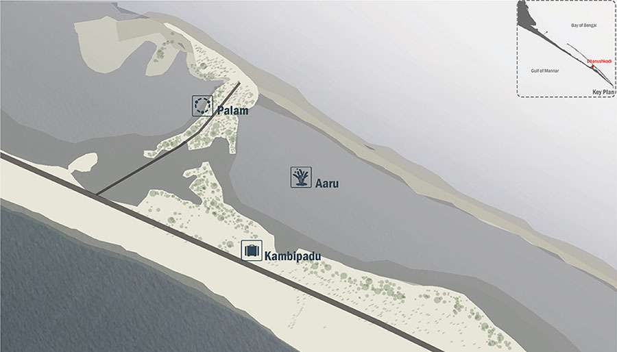
Paalam
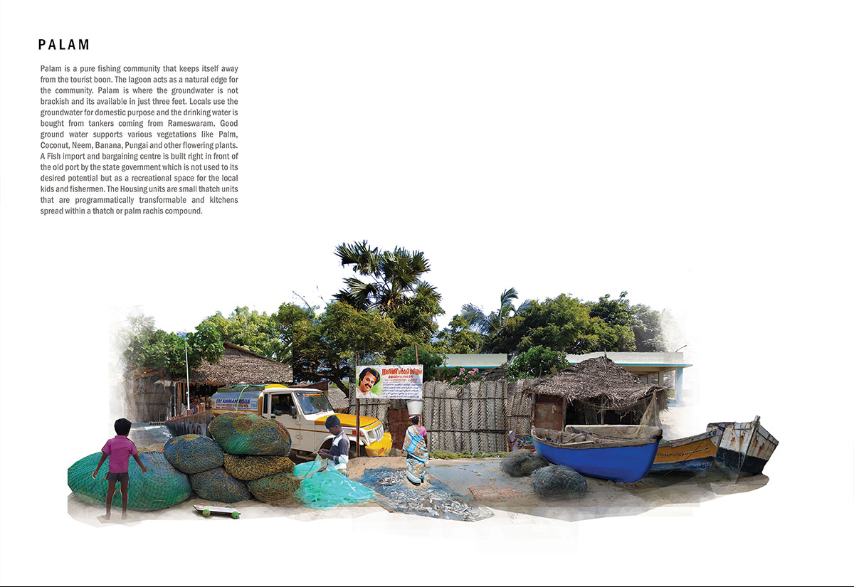
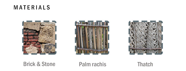
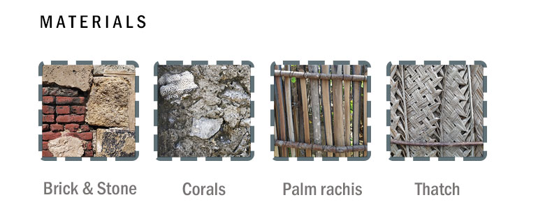
Palam is a pure fishing community that keeps itself away from the tourist boon. The lagoon acts as a natural edge for the community. Palam is where the groundwater is not brackish and its available in just three feet. Locals use the groundwater for domestic purpose and the drinking water is bought from tankers coming from Rameswaram. Good ground water supports various vegetations like Palm, Coconut, Neem, Banana, Pungai and other flowering plants. A Fish import and bargaining centre is built right in front of the old port by the state government which is not used to its desired potential but as a recreational space for the local kids and fishermen. The Housing units are small thatch units that are programmatically transformable and kitchens spread within a thatch or palm rachis compound.
Kambipadu
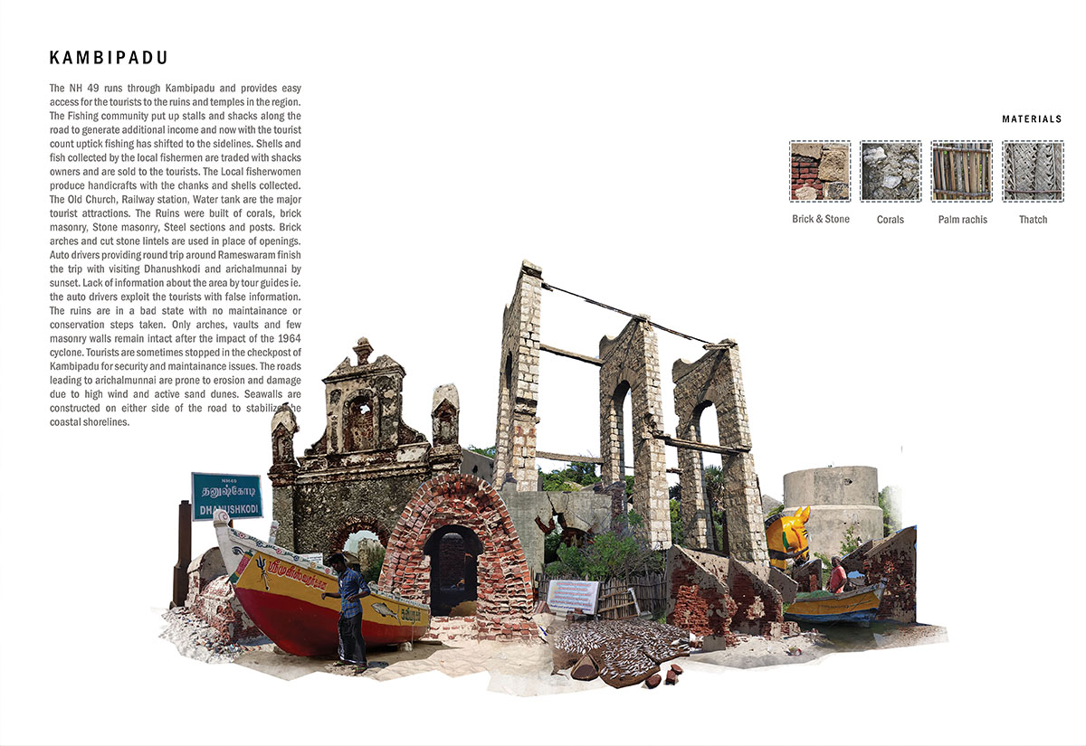
The NH 49 runs through Kambipadu providing easy access for the tourists to the ruins. The locals put up stalls and shacks along the road to generate additional income. Now with the tourist count uptick fishing has shifted to the sidelines. Shells collected by the local fishermen are traded with fisherwomen who produce handicrafts that are sold to the tourists. The Old Church, Railway station, Water tank are major tourist attractions. The Ruins are built of corals, brick, Stone masonry, steel posts and sections. Auto drivers providing round trip around Rameswaram, finish the trip by visiting Dhanushkodi at sunset. Auto drivers lack in information about the ruins, exploit the tourists with false information. Only arches, vaults and few masonry walls remain intact post cyclone. The ruins are in a bad state with no maintainance.
Aaru
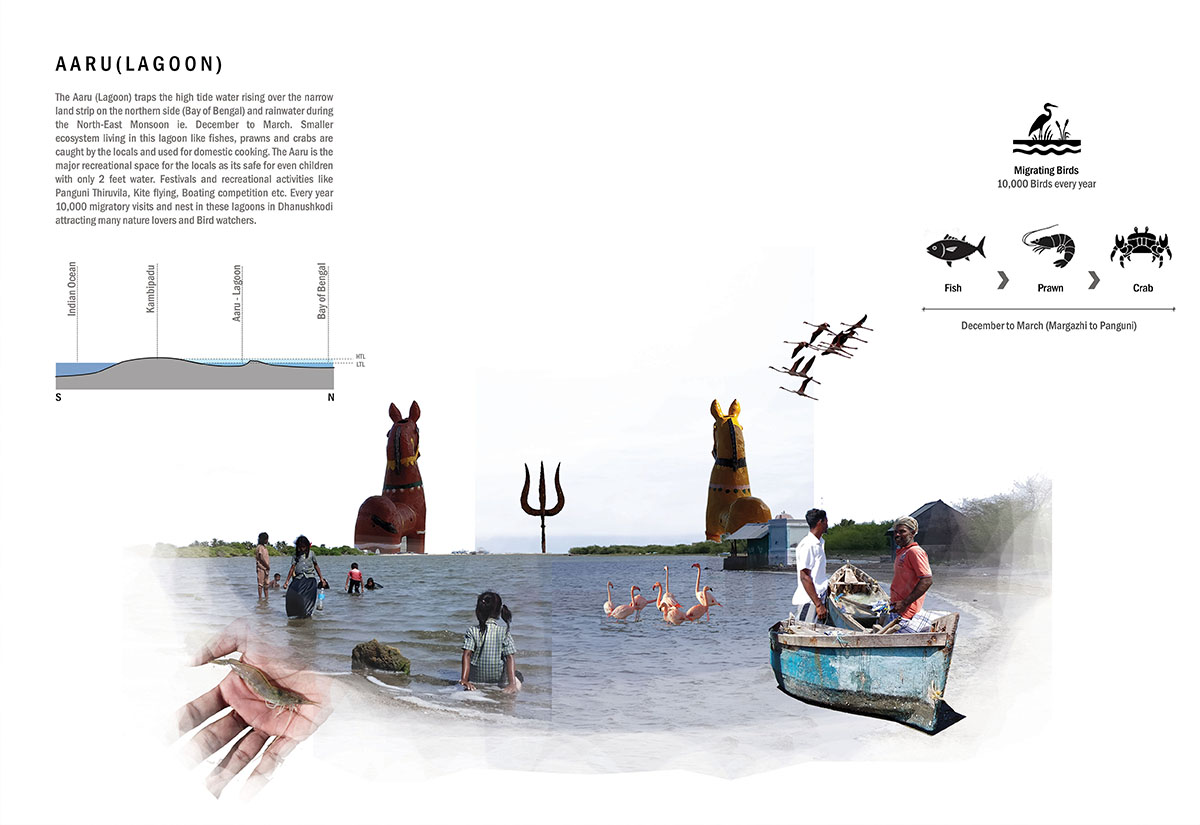
The Aaru (Lagoon) traps the high tide water rising over the narrow land strip on the northern side (Bay of Bengal) and rainwater during the North-East Monsoon (Dec to Mar). Smaller ecosystem living in this lagoon like fish, prawns and crabs are caught by the locals and used for domestic cooking. The Aaru is the major recreational space for the locals as its safe for children with only 2 feet water. Festivals and recreational activities like Panguni Thiruvizha, Kite flying, Boat race etc. Every year 10,000 migratory visits and nest in these lagoons in Dhanushkodi attracting many nature lovers and bird watchers.
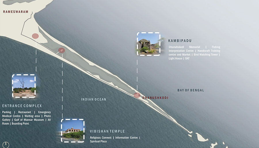

Gallery